 Listen


 Facebook
 Reddit
 Copy Link


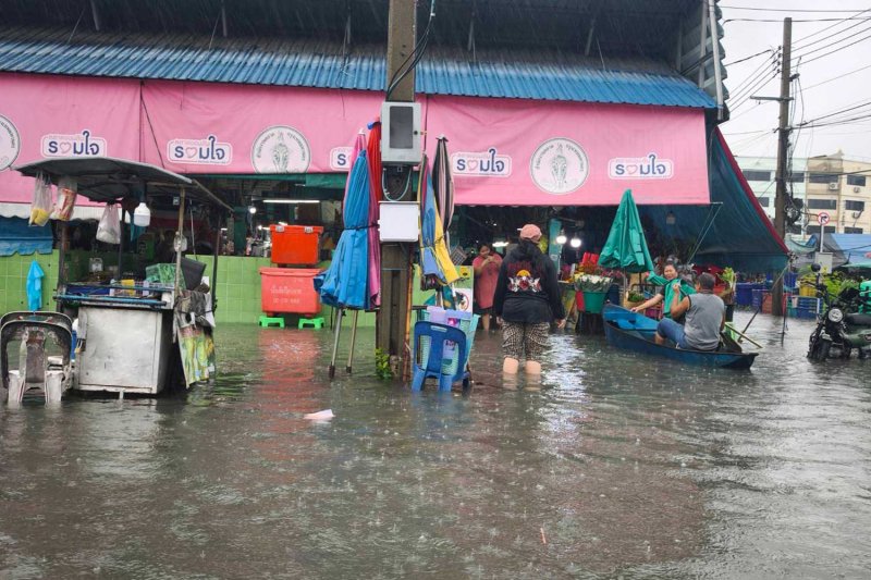
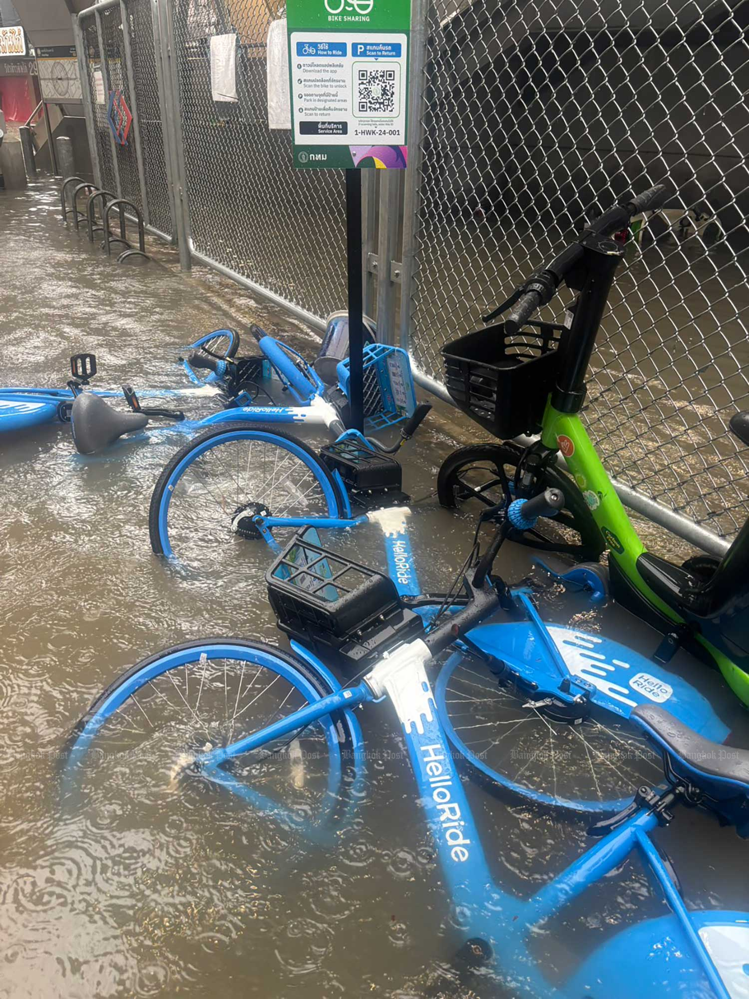
Eastern Bangkok is heavily flooded, with all local canals full and 15 main roads deeply inundated on Saturday morning, according to Bangkok governor Chadchart Sittipunt.
Rain in the capital began at 4pm on Thursday, with accumulations nearing 300 millimetres in Min Buri, Klong Sam Wa and Saphan Sung districts by Saturday morning.
“It has rained heavily in the eastern part of Bangkok, and more rain is coming from Nonthaburi and Pathum Thani provinces. The situation has not improved,” said Mr Chadchart, who has declared disaster zones in all 50 districts of the capital in order to speed up the flood response.
“We are trying to cope by pumping out floodwater, but all canals in eastern Bangkok are now full. People living near canals are at risk,” he said, referring to the Saen Saep, Prawet, Lat Phrao and Prem Prachakorn canals.
He advised affected residents near canals to move valuables and vehicles to higher ground as the rain could continue.
Floodwater was also flowing into the capital from Nonthaburi and Pathum Thani, he said.
Bedridden people in flooded areas would be moved to hospitals and other people who must leave their houses could take shelter at schools tun by the Bangkok Metropolitan Administration (BMA), Mr Chadchart said.
The BMA has made sandbags available at district offices for anyone who requests them. If the rain stops, floodwater should recede within six hours.
Motorists were advised to avoid 15 main roads that were heavily flooded:
- Vibhavadi Road (flooded from Chatuchak through Lak Si to Don Muang)
- Din Daeng Road (between the Din Daeng and Asok-Din Daeng intersections)
- Phahon Yothin Road (at the five-way Lat Phrao intersection, Kasetsart University, Bang Bua, Lak Si and Saphan Mai as well as between Saphan Khwai and Ari)
- Suwinthawong Road (from Min Buri to Wat Saen Suk)
- Srinagarindra Road (from Bang Kapi to Hua Mak, Pattanakan, On Nut, Seacon Square and Bang Na)
- Ratchadaphisek Road (from Rama IX to Huai Khwang, the Lat Phrao intersection and Ratchayothin)
- Ngam Wong Wan Road (from The Mall Ngam Wong Wan to Kaset intersection)
- Lat Krabang Road (from Suvarnabhumi airport to Ramkhamhaeng, Bang Kapi and Saphan Sung)
- Pattanakan Road (along the entire route)
- Lat Phrao Road (from the Ratchada-Lat Phrao intersection to Wang Thonglang and Bang Kapi)
- On Nut Road (from Sukhumvit 77 to On Nut 17, the Srinagarindra intersection and Prawet)
- Phetchaburi Road (from Makkasan to Asok, Thong Lor and Ekkamai)
- Chaeng Watthana Road (from Lak Si to the Chaeng Watthana expressway)
- Sukhumvit Road (from Bang Na to Udom Suk)
- Ram Intra Road (from Bang Khen to the Km 2 marker)
Alleys near canals were also flooded, but there were no flooding problems in western Bangkok, on the other side of the Chao Phraya River, the governor said.
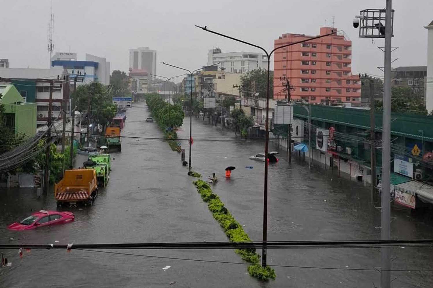
Nawamin Road near the Bang Kapi intersection in Bang Kapi district. (Photo: Lat Phrao police station)
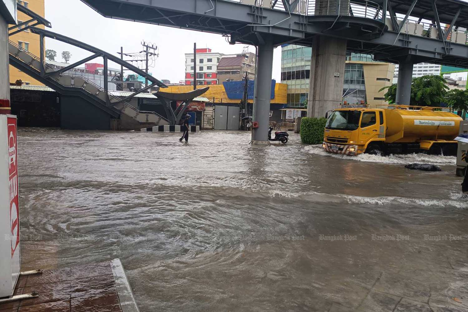
Phahon Yothin Road at the Ratchayothin intersection. (Photo: Nareerat Wiriyapong)
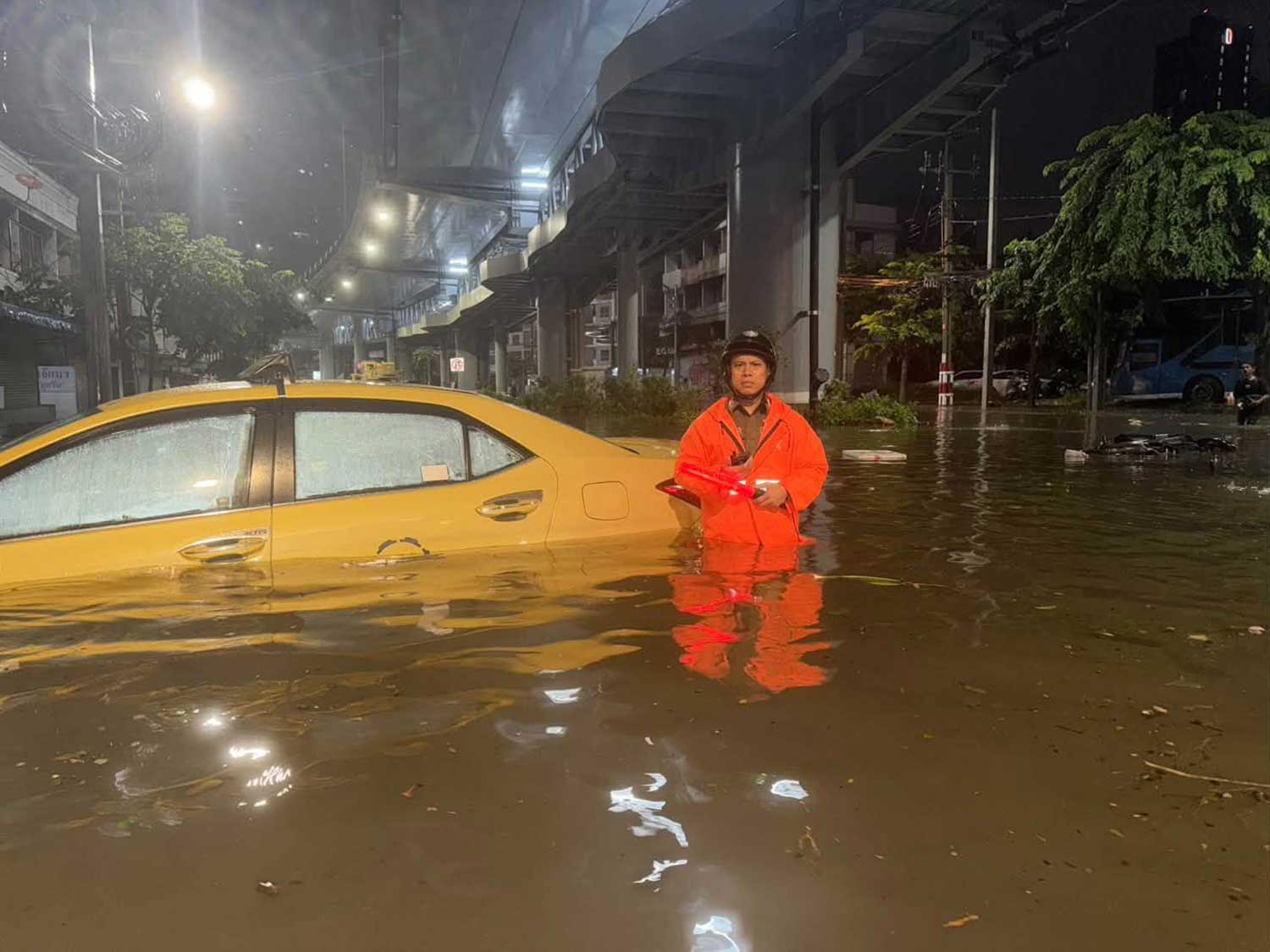
Floodwater is waist-deep at the Bang Kapi intersection near the Saen Saep canal in Bang Kapi district early Saturday morning. (Photo: Lat Phrao police station)
Lat Phrao 41 Road in Chatuchak district of Bangkok on Saturday morning. (Photo: Charoen Kittikanya)
